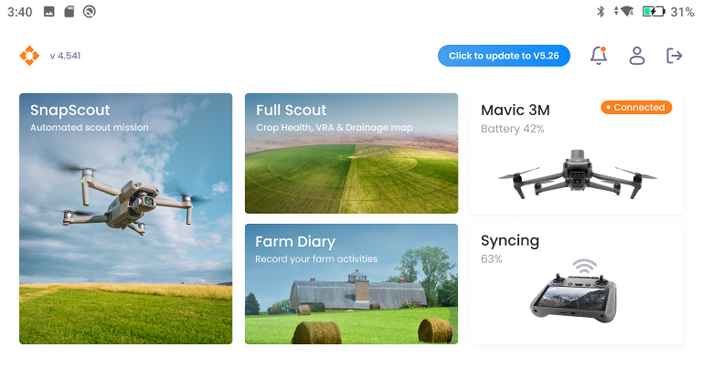
A platform that uses drones and AI to deliver deep insights for the agriculture and forestry industries, without any technical complexity.
Crop Scouting Platform by Farmevo
Scout smarter with leaf level Insights
Use drones without technical expertise to enhance the crop scouting process and deliver timely, accurate crop insights.


From data capture to actionable insights
Data capture to analytics and map-based reporting—so users get results instantly with zero technical expertise.

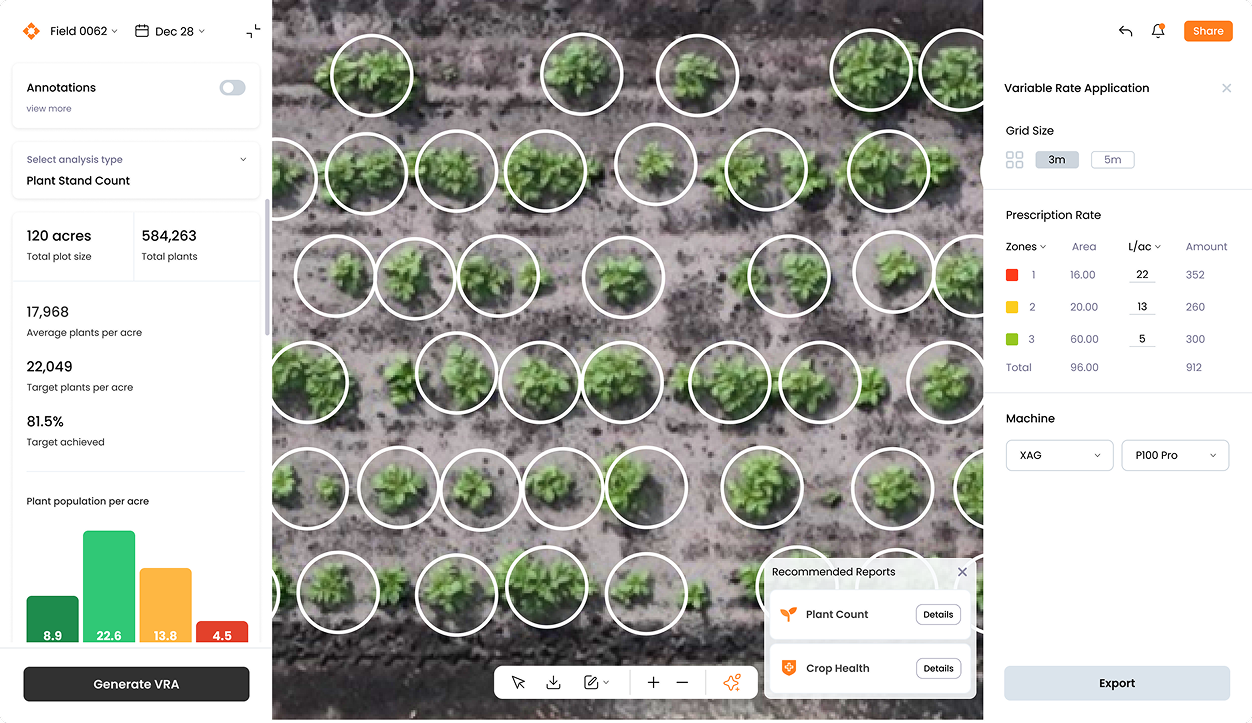
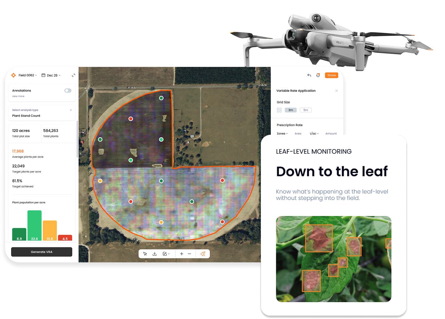
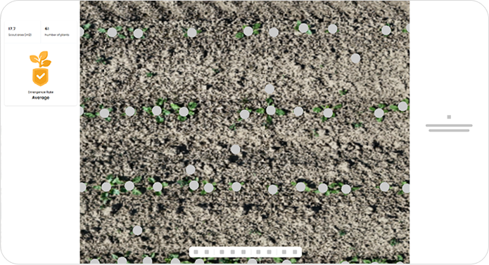
Detect stress, disease and nutrient deficiencies early with high resolution, leaf-level insights across the field.

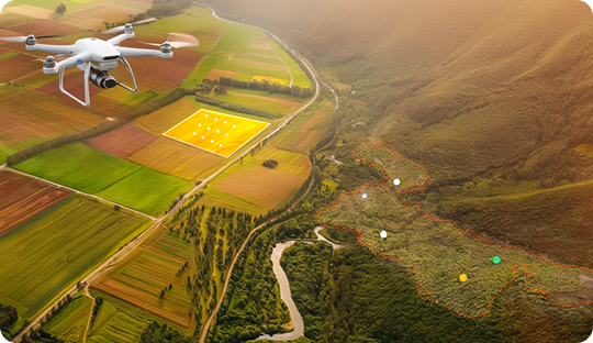
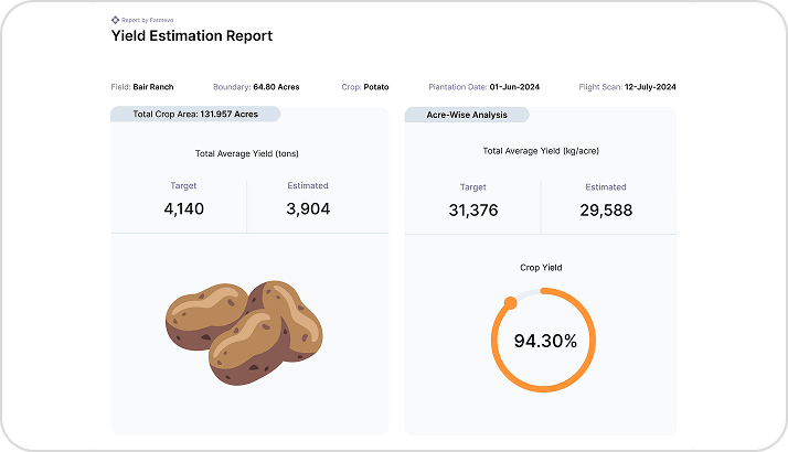
Enable timely decisions with accurate, field-level insights to optimize seeding, irrigation, chemical application, and harvest timing.

Reduce input costs by treating only affected spots with accurate field intelligence.
LenseAI pilot app features


Automated drone analysis that delivers stand counts, crop health indicators, and early yield signals, without the need for manual field scouting.
Step 01
Collect field imagery using readily available drones and Farmevo’s mobile app, no specialized sensors or complex flight planning required.
Step 02
Drone imagery is automatically processed to generate maps, counts, and analytics, from snap scouting to full-scout surveys, without manual data handling.
Step 03
Access your field’s real time maps, dashboards, and reports all within one platform.
Digital Silviculture Platform by Farmevo
Forestry intelligence made accessible & affordable
Digitalizing silviculture through precise, automated and scalable drone-based solutions.


Built for silviculture teams
SylvaSense enables forestry teams to augment manual surveys with automated drone surveys delivering 3-5x quicker insights, higher accuracy, and consistent reporting at scale.

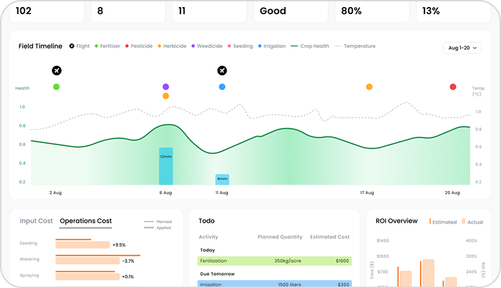
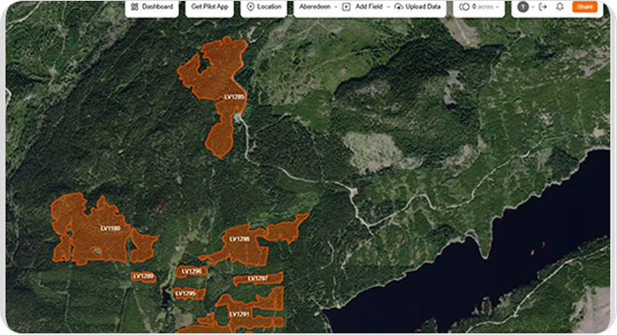
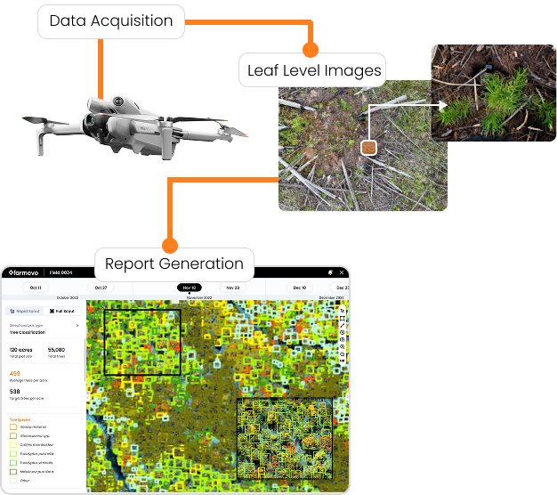
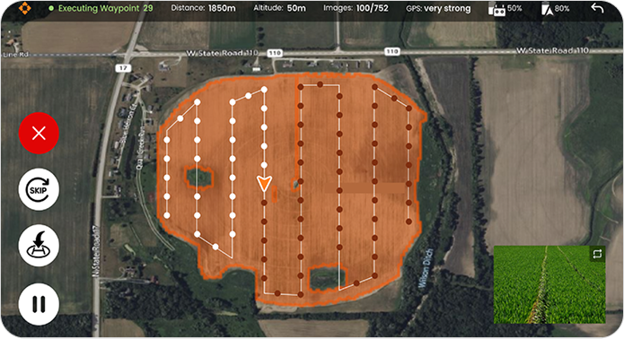
Data capture to analytics and map based reporting so users can view results on portal within 12 hours and get instant results with zero technical expertise.

Reduce man hours cost through faster coverage.

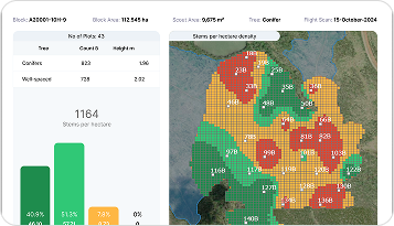
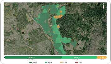
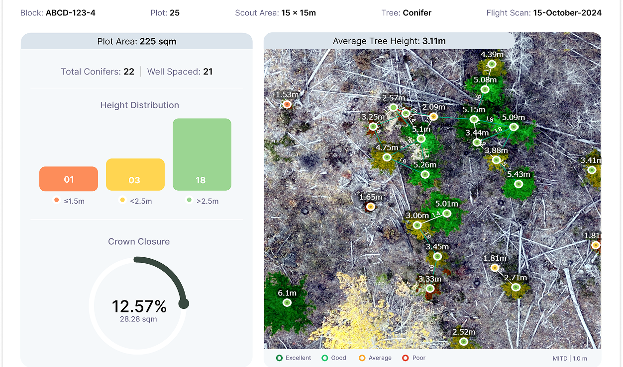
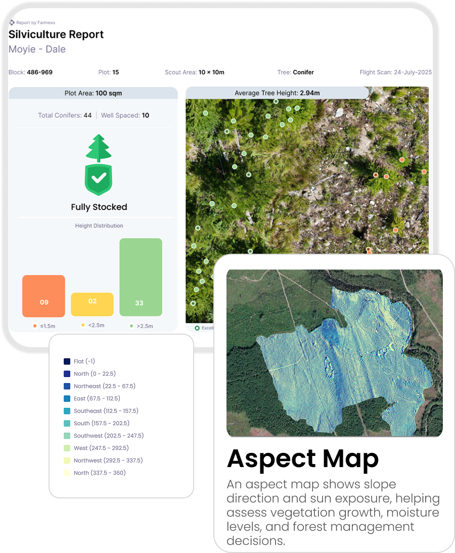
Monitor & detect tree species, terrain and well spaced distribution to support healthier forests.
Simple platform


Farmevo SylvaSense combines recce overviews and plot-level surveys to deliver fast, reliable silviculture intelligence. Recce missions generate high-resolution RGB maps with elevation and aspect layers for better cut block visibility without walkthrough surveys while plot surveys capture leaf-level detail to produce accurate silviculture insights.
Step 01
Collect forest imagery using readily available drones and Farmevo’s mobile app, no specialized sensors or complex flight planning required.
Step 02
Drone imagery is automatically processed to generate maps, counts, and analytics, from plot & block level surveys,without manual data handling.
Step 03
Access maps, dashboards, and reports with plot & block level surveys, ready for planning, monitoring, and reporting.